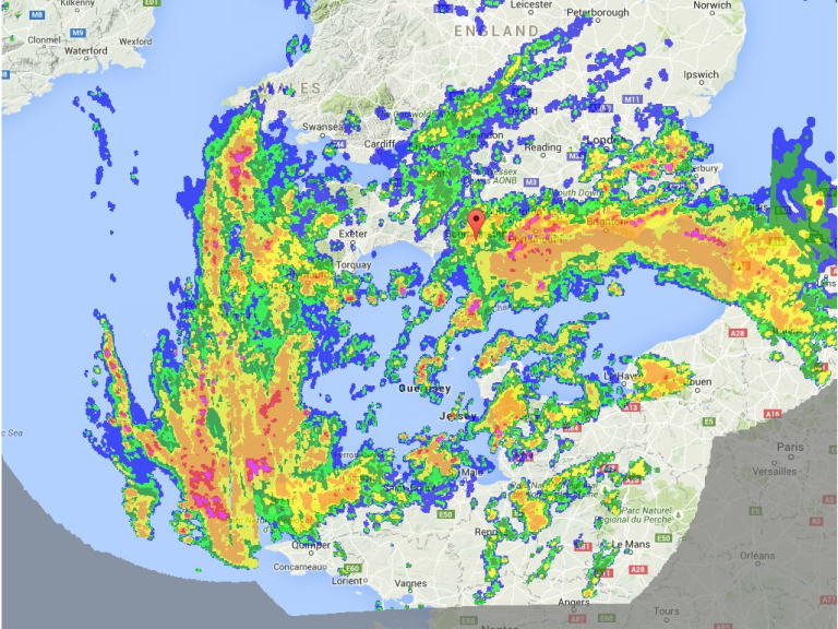


A Met Office severe weather warning is in place until 10pm, with the downpour expected to continue until the afternoon.
Radar maps show an area of rain moving in from the south.
The Met Office weather warning reads: "An area of rain will run into the UK from the south on Monday morning, with some persistent and heavy rainfall in places.
"The public should be aware of the risk of flooding, including disruption to travel. In addition to this there is the potential for strong winds, particularly around exposed coastal areas.
"A low pressure system is expected to run into the UK from the south on Monday morning, bringing areas of heavy rain particularly across some southern areas of England.
"There remains some uncertainty over this development and the locations of the heaviest rain.
"However, there is the potential for 20-40 mm to fall quite widely with more than 60 mm possible in some places, much of this falling in a short period of time.
The warning covers Bournemouth, Poole and Dorset.
The rest of the week is set to be unsettled. Thunderstorms predicted to hit today are now foreast for Tuesday lunchtime. Wednesday will be sunny and Thursday showery.
Temperatures are expected to be 17C on Monday and 18C for the rest of the week.
- Daily Echo.
The following Cookies are used on this site. Users who allow all the Cookies will enjoy the best experience and all functionality on the site will be available to you.
You can choose to disable any of the Cookies by un-ticking the box below but if you do so your experience with the Site is likely to be diminished.
In order to interact with this site.
To show content from Google Maps.
To show content from YouTube.
To show content from Vimeo.
To share content across multiple platforms.
To view and book events.
To show user avatars and twitter feeds.
To show content from TourMkr.
To interact with Facebook.
To show content from WalkInto.