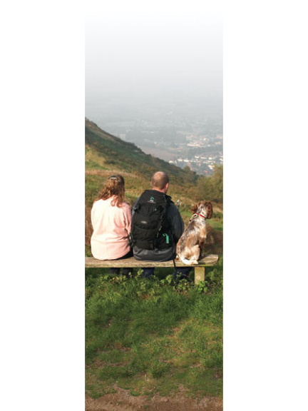
The town of Great Malvern lies at the Northern end of the Hills on the Worcestershire side, underneath the Worcestershire Beacon and North Hill. There is direct walking access to the Hills from the town via the path and 99 steps up to St Ann's Well (and café). The smaller village of Colwall lies on the Western slope of the Hills, about one third down their length. Both Great Malvern and Colwall have railway stations on the Worcester to Hereford line that can be used as starting points for a visit to the Hills. There are car parks located at points all round the hills. The highest one is located on Beacon Road at the Wyche Cutting (B4218 road from Malvern to Colwall). This is also the closest to the Worcestershire Beacon. For those wanting to walk the Hills from end to end, the car parks to use are at the Clock Tower at the Northern end (on North Malvern Road) and at Hollybush at the Southern end (on the A438 Ledbury to Tewkesbury Road). Hollybush isn't quite at the very Southern end as Chase End Hill is only reachable on foot, although there is a minor road that goes to Whiteleaved Oak. The other major car park is at British Camp. This is situated about half way along the Hills, on the A449 Malvern to Ledbury road, and is the car park to use for the Herefordshire Beacon and points south. For those with difficulties walking, the Conservators have constructed "easier access paths" and disabled parking spaces at Blackhill Car Park on Jubilee Drive (B4232 road from Wyche Cutting to British Camp on the Western side of the Hills) and at Earnslaw Quarry on Wyche Road (B4218). There are public toilets at St Ann's Well, the Wyche Cutting and at British Camp.
Dedicated to building TBO Malvern but I still like to find time to play golf, usually on a Friday afternoon.Decorating and gardening is best left to the lovely Mrs Cook!
The following Cookies are used on this Site. Users who allow all the Cookies will enjoy the best experience and all functionality on the Site will be available to you.
You can choose to disable any of the Cookies by un-ticking the box below but if you do so your experience with the Site is likely to be diminished.
In order to interact with this site.
To help us to measure how users interact with content and pages on the Site so we can make
things better.
To show content from Google Maps.
To show content from YouTube.
To show content from Vimeo.
To share content across multiple platforms.
To view and book events.
To show user avatars and twitter feeds.
To show content from TourMkr.
To interact with Facebook.
To show content from WalkInto.